Do you ever find yourself asking the question: Where did I put that document…? Over the last decade or so, we’ve undergone a dramatic transition from the use of paper documents to electronic file management, but not all digital filing cabinets are created equal. Important documents still get lost, deleted, and stored incorrectly.
Enter: AssetAlly.
One of the main functions of AssetAlly is simplified document management. As an example, we’ll highlight how the Village of Sister Bay, WI uses the Document Management Tool to easily track their well permit and impact fee documents.
WELL PERMITS AND IMPACT FEES
To comply with Wisconsin DNR standards, the Village needs to test their wells to every five years.
Impact fees are a one-time fee that municipal customers pay before building, remodeling, or adding additions on their property.
The Village was looking for an easier, more efficient way to manage the large number of documents necessary to track their well permits and impact fees. AssetAlly now allows the Village to store and access both well permit and impact fee documents in one location by uploading them into their GIS application and attaching them to parcels.
“[The document management tool] provides fast and easy access. Once entered, you can pinpoint on the map exactly what properties have well permits and/or impact fees. I can use the GIS to find documents instead of driving to different buildings and searching through file cabinets.”
Because these documents are now easily accessible, Kara no longer needs to make frequent trips to the buildings where documents were previously stored. Kara also emphasized that the benefits are growing exponentially as more documents are added, resulting in an increase in the number of times of needing to call back on documentation.
Document Uploads in AssetAlly
Uploading documents into AssetAlly can be completed in just a few mouse-clicks.
To upload a document from inside the map, just use the Add Document tool, located in the Document Management tab of the Toolbar.
Accessing documents in AssetAlly can be done either through the Portal Page Document Search, or in GIS Map View. If using the Portal Page, click on the Documents widget to access the Document Search page.
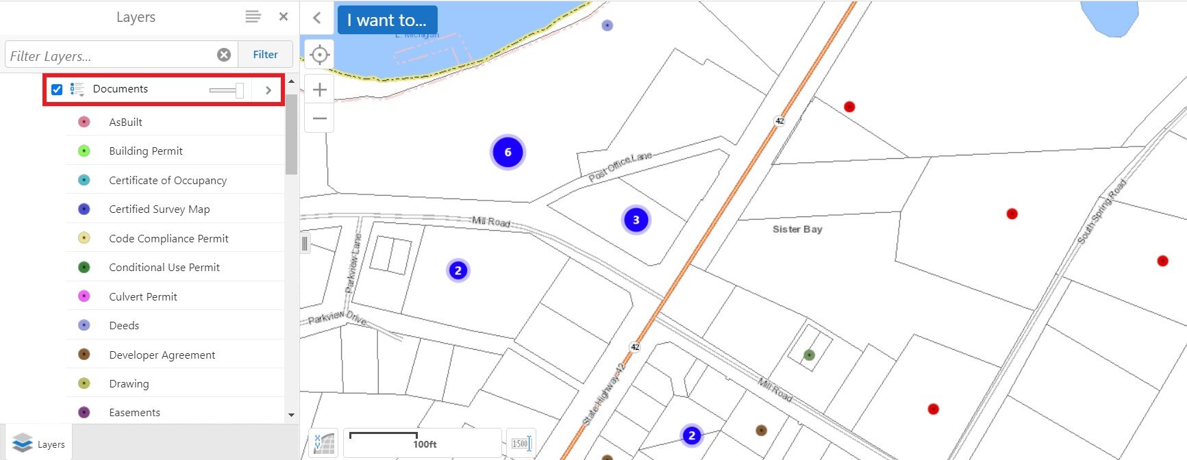
If you know the parcel location that has document attached to it, you can also go into the GIS Map Viewer. Turn on the document layer to see where documents are spatially located.
And just like that, your documents are available to submit to regulatory agencies, share across departments, and access any time you need them.
Learn More
For a more detailed explanation of how to upload and attach documents into your AssetAlly site, click here or contact one of our experts today.!


